UC Berkeley
Intelligent Intersections
Total processed: 737591 intersections
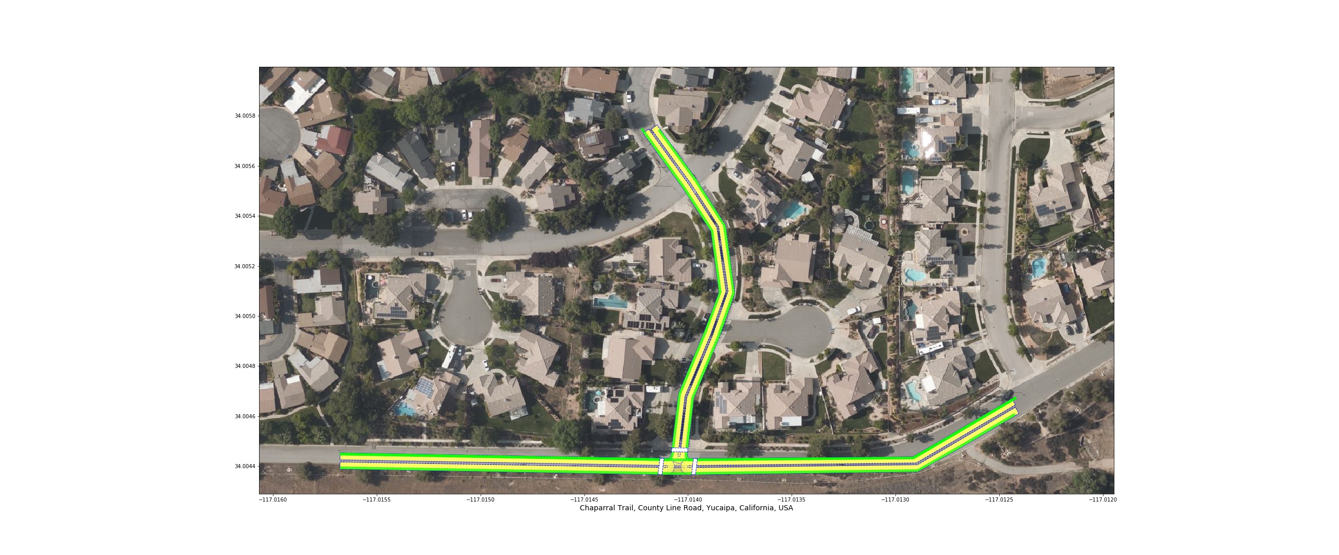
Chaparral_Trail, County_Line_Road, Yucaipa, CA, USA
- approach_counts = {'oneway': 0, 'twoway': 4, 'singleway': 0}
- approach_max_speed_limit = 25 mph
- approach_min_speed_limit = 25 mph
- approach_street_types = {'residential': 2, 'cycleway': 4}
- diameter = 16.680934696137264
- distance_to_next_intersection = 60.8405957091834
- download = https://iit-intersections.s3-us-west-1.amazonaws.com/USA/CA/Yucaipa/Chaparral_Trail-x-County_Line_Road.json
- exit_counts = {'oneway': 0, 'twoway': 4, 'singleway': 0}
- exit_max_speed_limit = 25 mph
- exit_min_speed_limit = 25 mph
- exit_street_types = {'residential': 2, 'cycleway': 4}
- max_angle = 95.70960291741414
- max_curvature = 1.4943597670132756
- max_number_of_lanes_in_approach = 1
- max_number_of_lanes_in_exit = 1
- min_curvature = 0.0
- min_number_of_lanes_in_approach = 1
- min_number_of_lanes_in_exit = 1
- number_of_approaches = 4
- number_of_bus/trolley_stops = 0
- number_of_center_bicycle_approaches = 0
- number_of_center_bicycle_exits = 0
- number_of_exits = 4
- number_of_railway_approaches = 0
- number_of_railway_exits = 0
- number_of_right_side_bicycle_approaches = 4
- number_of_right_side_bicycle_exits = 4
- number_of_tram/train_stops = 0
- pedestrian_signal_present = None
- shortest_distance_to_railway_crossing = -1
- signal_present = None
- stop_sign = None
- subway_station_present = no
- timestamp = 2020-06-19 05:20:23.594978
Prev Next


